Day Four - The rhythm changes.
It was great to finish today in a reasonable shape. I was absolutely done in yesterday.
 Today Jim was filming the finish and asked me to go past where the guys were and then get out of the river. “Just down past that log mate, you can go round it,” said Jim. The log was sitting on the left bank and the right bank! How does one paddle around that? I thought he was having a go at me but he reckons he was serious. There was nothing special about the log, it was about 200mm above the water in the middle so I just went for full power and bounced over it. I still reckon he was having a go though.
There was a fair bit of knuckle work with the fast bits today. At one stage the kayak got spun around while I sat on a mound of clay but I managed to keep going until deep water. It was a bit of a bother as I had knuckled it for 20m, was just at the crest and then got stuck sideways for a few minutes while I struggled with the flow.
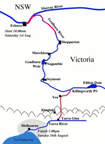
Tomorrow we should reach Shepparton but I don’t know how far it is. The log for today was 35.25km which is still just above what we need to do.
Tonight we had a baked meal at Gary and Julie Godwill’s where we are staying for a couple of days. It is just like we died and went to heaven – great food, log fire, and all the rain is on the roof, not on the tent.
From Giovanni
Take a drive down to any major river anywhere in Victoria and you will get the same picture. Back from the natural fiver bank there will be a levee that more or less follows the course of the river. Its job is to hold back the major floods of the river from inundating the entire landscape.
Behind that, the network of natural waterways will have been roughly modified and shaped to hold and move water. Pumping stations and pipelines will lead you to the head of the major irrigation channels which are around two metres higher than the surrounding landscape and possibly four metres deep. Off them, run the main channels, which are less than a metre higher than the landscape and around two metres deep. At every farm, a gate allows the farmer to take water from the irrigation channel into their own paddocks or into the spur which supplies them and, in some cases, their neighbours.
This infrastructure is managed by the relevant water authority. In this region that is the Goulburn Murray Water Authority, rumoured to be the largest water authority in the Southern Hemisphere.
On the individual farms, paddocks are divided into cells with small levees possibly 150mm high, that allow specific crops to be watered. These cells are about the size of houseblocks but are not fenced. As you drive down the grid of roads on this landscape, the levees flick by hypnotically. The occasional change in crop adds variety to the rhythm.
This pattern extends from the Little Desert in the west and the Murray in the north all the way to the Great Dividing Range in the south and the east.
The same pattern of water provision is used for fruit, canola, wheat, rice, sheep and cattle. Some cattle graze on irrigated pasture but there are many feedlots. Right now, there is almost no water in the system because of the ongoing drought, now entrenched for a decade, but recent rains have wet the soil, providing good cover. Many farmers have crops of wheat or canola in. Farmers are currently allowed 30% of their water allocation, which means they can afford to irrigate a small part of their land now. The rivers are low in winter and are swollen by the spring melt and run for the early part of summer.
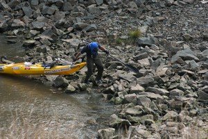
Out of the river ...

... and into the cut

The river bank is reinforced by levees

Water is pumped into the main channels and flows into individual farm channels

Some of the main channels are being lined.
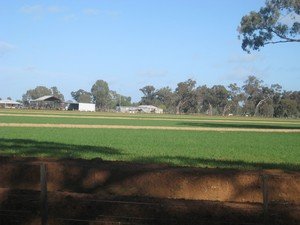
Each paddock is divided into individual bays so a small area can be irrigated if necessary

Irrigated pasture is sometimes fed to cattle kept in feedlots.